
Walk a Columbus Street Directory
A Columbus address search begins by making the address precise. Keep the house number, directional, suffix, unit, city, state, and ZIP in separate notes. USPS can normalize a current mailing form, but postal routing does not prove that a parcel lies inside Columbus. Next, locate the physical parcel in a county map and save its parcel identifier, or parcel ID. That key can connect map, assessment, and recorded-land references even when a street label changes.
The public sources establish different facts. The Assessor supplies valuation and an owner display. The Recorder preserves deeds and other instruments that bear on title. A voter record may support current registration but is subject to access rules and confidentiality. Printed directories can show an occupant or business at an earlier date. None alone is a complete household list.
- Normalize the address with the USPS lookup, then retain the exact street and unit form returned.
- Open Bartholomew County Elevate and Beacon. Match the situs address, map position, and parcel ID.
- Record the displayed owner and mailing address, keeping both separate from the physical situs.
- Use the owner and legal description in the Recorder’s Doxpop index, then follow each grantor and grantee link.
- For lawful historical research, compare the address with Columbus directory editions and the nearest census year.
Columbus Street Maps Use Two Portals
The Bartholomew County Assessor directs readers to Elevate, while county navigation and the Recorder point to Beacon. This portal split matters. Open Elevate and the Beacon parcel map side by side, then confirm that the parcel ID and map location agree before combining facts from their result panels.
The live interfaces did not expose a stable field schema during research, so the street directory should not promise a control that may move or disappear. Look for the following record elements and transcribe labels exactly as the portal displays them.
| Portal element | Likely use | Check before relying |
|---|---|---|
| Property address | Find the physical parcel | Distinguish situs from mailing address |
| Parcel ID | Bridge map and county records | Preserve every digit and separator |
| Owner display | Start a deed search | Confirm title in Recorder records |
| Legal description | Match subdivision, lot, or tract | Compare with the instrument image |
| Value fields | Read the assessment | Do not treat value as sale price |
The Assessor’s annual cycle can also explain a changed value. Bartholomew County reassesses one quarter of parcels each year, with part of Columbus assigned across the published cycle. A new assessment date does not date a building or prove a sale.
See the live Bartholomew County Beacon source before using its map controls.
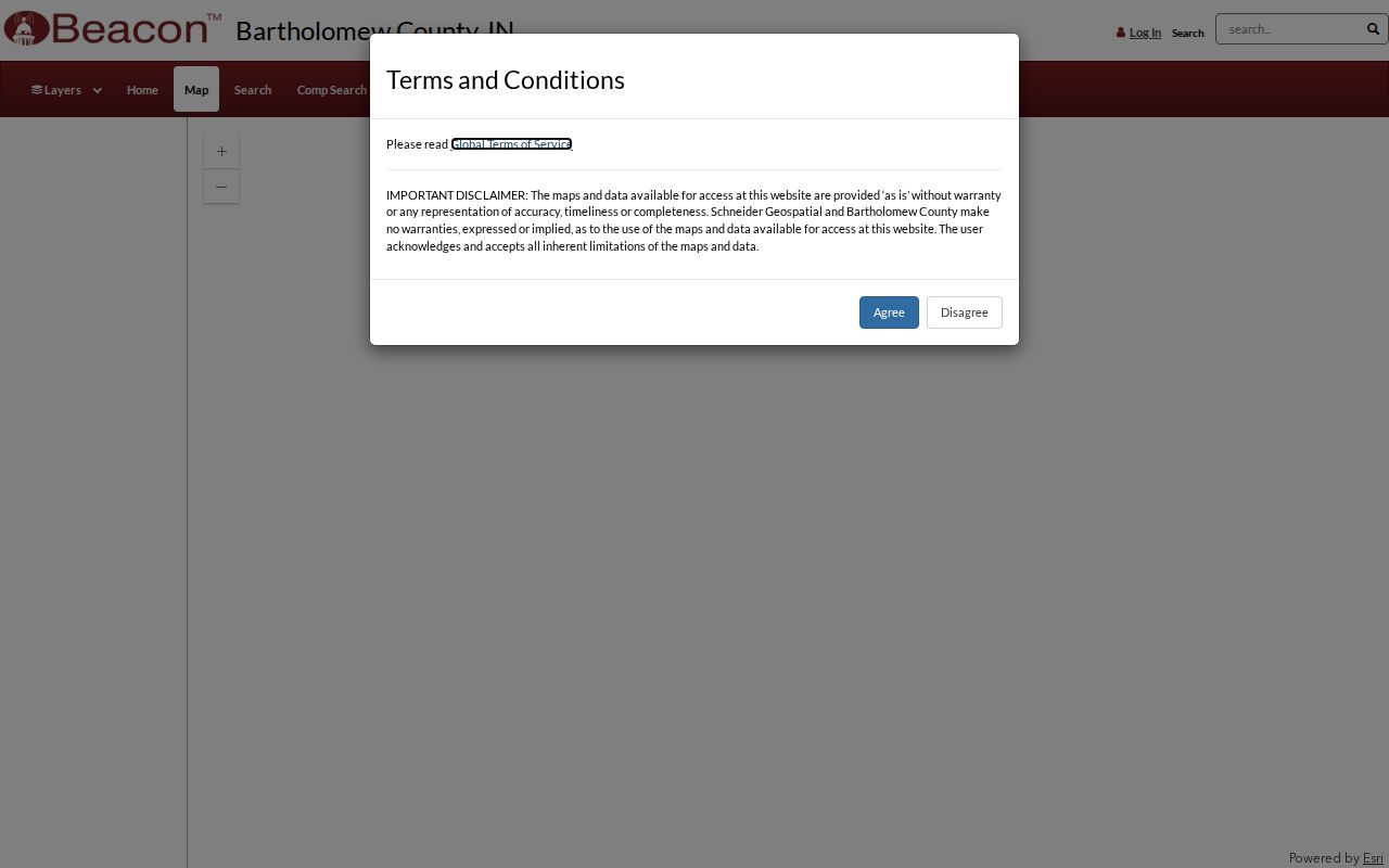
The captured entry point confirms the county map route; live parcel details still need to be checked at search time.
Columbus Street Records by Address
Several custodians can answer an address question, but each covers a narrow record family. Use the street directory as a chain of evidence, not a merged roster. Current parcel data leads to the legal description. That description points into deeds and plats. Planning files can document work or a land-use request, while a historical directory may name a former occupant.
| Record Set | Keeper | What It Shows | Access |
|---|---|---|---|
| Assessment and parcel | County Assessor | Owner display, situs, mailing address, values | Elevate, Beacon, or office |
| Parcel geography | County GIS and Surveyor | Lot lines, nearby parcels, city map context | Online map or map office |
| Deeds, liens, and plats | County Recorder | Grantor, grantee, instrument, legal description | Doxpop, office computer, books, film |
| Voter information | County Clerk | Authorized computerized voter data | VRG-24 request; self-service portal |
| Planning and code files | City Planning or county code office | Applications, owner authorization, case context | OpenGov and office request |
The parcel ID is usually the safest bridge. Street spelling can vary, and tax mail may go elsewhere. When a portal gives no result, visit or call the office with the address, parcel ID, record type, and date range. Written requests under Indiana APRA should describe an existing record with reasonable detail; an office is not required to create a new street-wide list.
Columbus Situs and Mailing Addresses
A situs address is the physical location assigned to a parcel. The mailing address is where tax correspondence goes. It may belong to the same site, a post-office box, or another place. This is the most useful Columbus street directory caution because a mailing field can make an owner appear to live on a different street, and an owner display does not identify every occupant.
- Parcel
- A mapped unit of land identified by the county for assessment and record matching.
- Situs address
- The physical property address, distinct from the tax mailing destination.
- Plat
- A recorded map that shows lots, blocks, streets, and related survey information.
- Criss-cross directory
- A directory arranged by street and house number instead of surname.
Compare both address fields with the legal description and parcel map. Then cite which field supported the conclusion. A Treasurer record can help with tax-account context, but it does not replace the recorded deed.
Note: Preserve the portal’s source date because owners, addresses, assessments, and map layers can change on different schedules.
Deeds Along a Columbus Street
The Bartholomew County Recorder keeps deeds, mortgages, releases, assignments, plats, surveys, annexations, liens, and other land instruments. Start in Doxpop with the displayed owner as a grantee. On the deed, copy the grantor, grantee, instrument number, recording date, document date, book and page if shown, and legal description. Recording date and document date are not interchangeable.
The online index begins in January 1963. Earlier work continues through Recorder books and public computers, State Library land-deed and plat film covering 1822 through 1962, and selected County Archives holdings from 1821 into the early 1900s. That handoff is a change in access, not evidence that the older land record vanished.
Copies are listed at $1 per page for pages 11 by 17 inches or smaller, and certification is $5 under the Recorder’s published fee notes. Confirm the current amount before ordering. For a street-wide project, keep one row per instrument and never infer consideration or sale price from assessed value.
Columbus Planning Files by Address
City Planning and county technical code offices divide the address work by jurisdiction and project type. The Columbus planning application page says applications moved to OpenGov on November 17, 2025. The process requires an account, property-owner authorization when applicable, any required meeting, and payment before processing. No complete public permit-index start year or stable result-field list was found.
That gap makes office contact important. Ask for a named application, permit, zoning matter, or code file tied to a specific address and date range. County Technical Code Enforcement covers listed construction such as new single-family structures, additions, garages, barns, and remodeling, while city planning handles its municipal categories. First confirm whether the parcel is within the city jurisdiction.
The current OpenGov application instructions appear in the captured planning page.
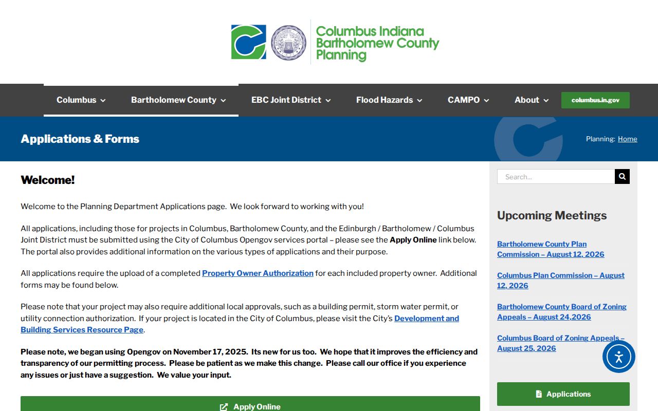
The screenshot documents the public application route, while each property’s file still requires a targeted address search or office request.
Historic Columbus Streets on Sanborn Sheets
The Library of Congress holds public Sanborn map sets for Columbus dated 1886, 1890, and 1898. These sheets add building footprints, use, construction clues, lot relationships, and older street alignment. Pair them with the closest printed directory and a deed description. A Sanborn sheet is a dated snapshot, not a modern parcel map or a continuous permit history.
No official Columbus street-renumbering year was found in the researched sources. When an old house number fails, compare successive directories, the city map street index, plats, deed descriptions, and Sanborn blocks. State the unresolved mismatch plainly instead of assigning an unsupported year. Columbus architecture files at BCPL and the Historical Society can add photographs or clippings after the block has been identified.
Note: A historical directory occupant and a deed owner may be different people, so record both roles with their sources and dates.
Columbus Property Watch Alerts
Bartholomew County residents can enroll in the Recorder-linked Property Watch service at no charge. The user supplies a property name or legal description, and the service emails notices when matching land filings arrive. This is useful after a street directory search has established the correct parcel and legal wording.
An alert does not block a filing, guarantee title, or prevent fraud. Treat it as a prompt to inspect the new instrument and contact the Recorder if the filing is unfamiliar. The service’s value is timely notice, not a conclusion about who owns or occupies the address.
Columbus Tax Addresses by Street
The Bartholomew County Treasurer adds a second address view to a street directory search. Tax records can show the owner mailing address used for notices and payment, while the parcel card identifies the situs address where the land lies. Those two addresses may differ for an owner who receives mail elsewhere, so neither field alone proves who occupies the building.
Use the Treasurer route to check tax-account context, receipts, and the county GIS link, then return to the Recorder for title instruments. Taxes are scheduled for May 10 and November 10, and the county lists 24-hour drop boxes at 440 Third Street. Payment status, assessed value, and recorded ownership are distinct facts. Label each one before combining records from the same Columbus street.
Limits of Columbus Street Records
A Columbus street directory cannot produce a complete, current list of everyone inside each home. Parcel records center on land and assessment. Deeds center on legal instruments. Voter material is governed by permitted uses, request rules, and confidentiality programs. No official public utility-customer list, school-zone household search, or comprehensive renter roster was located.
Indiana’s Address Confidentiality Program and restricted property-database rules can shield eligible people. A zero result may also reflect spelling, a unit format, a recently recorded change, a sealed record, or a source that is available only at a counter. Verify uncertain names with the custodian and avoid publishing sensitive address links.
Lawful use. Use Columbus address records only for lawful personal research, civic questions, family history, or property verification. Never use them to stalk, harass, intimidate, or harm anyone.